
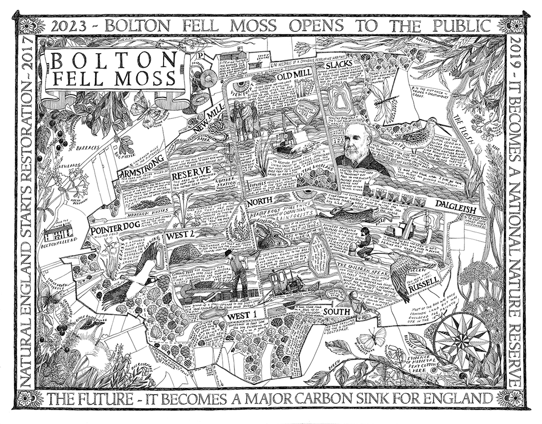
A Map of Bolton Fell Moss
A nine month project in collaboration with the University of Cumbria as an Honorary Research Fellow, National England and the PLACE collective. The map shows an area of lowland peat bog in Cumbria, formerly used for agricultural peat extraction but currently in restoration by National England. I approached the piece by mapping the land’s stories in layers of time. The past is represented by peat formation and a history of peat digging, referencing Cumbrian dialectic songs and quotes. The present is represented by environmental scientists and the restoration techniques they are using. (For this part of the piece, I interviewed local people involved in the restoration from nature wardens, to contractors, to academics). The future is represented by the restored bog in terms of climate change and it’s benefits to the local community as a carbon sink and a means of flooding prevention. I saw the carpet-like design of the original peat fields – all named – and fringed this carpet with the returning species of flora and fauna, the curlew, hares, peewits and cotton grass.
The drawing is in pen and ink on paper and is approximately 80×60 cms.
Related projects
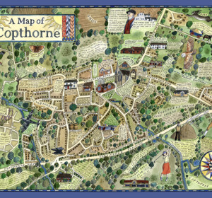
A Map of Copthorne
A map of the Sussex Weald village, Copthorne, commissioned as part of a walking and arts project, ‘About the Place’, by Mid Sussex

A Map of Crawley Down
A map of the Sussex Weald village, Crawley Down, commissioned as part of a walking and arts project, ‘About the Place’, by Mid Sussex
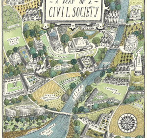
A Map of Civil Society
A map commissioned by Rethinking Civil Society, an academic project based at the University of York in collaboration with the Leverhulme Trust
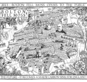
A Map of Bolton Fell Moss
A nine month project in collaboration with the University of Cumbria as an Honorary Research Fellow, National England and the PLACE collective.
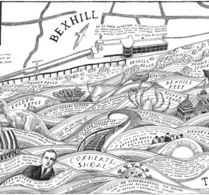
Mural: A Map of the Sea and the De La Warr Pavilion
A commission by the De La Warr Pavilion on the UK South Coast to create a mural of a map reflecting the Pavilion’s relationship with the
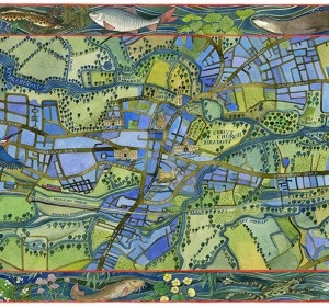
A Map of the Waterways of Oxford
An illustrated map of the waterways of Oxford showing the historic features of the city with borders of local river wildlife. Watercolour,

The Apple World
A map of the history, science and culture of the apple throughout the world, commissioned by the National Trust, the Museum of Cider and the
Mural: A Map of the Midsummer Stars above Brighton
I was commissioned to adapt my original ‘Map of the Winter Stars from the Northern Hemisphere’ into a mural by MMoser Associates. The

A Map of Gyptian Waterways in Oxford
I was commissioned by Badwolf to create this map prop of the waterways of Oxford for the BBC/HBO production of ‘His Dark Materials’ .
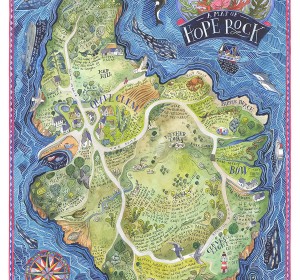
A Map of Hope Rock
I was commissioned to create this imagined island for Thames and Hudson’s ‘Archipelago; An Atlas of Imagined Islands’, edited