
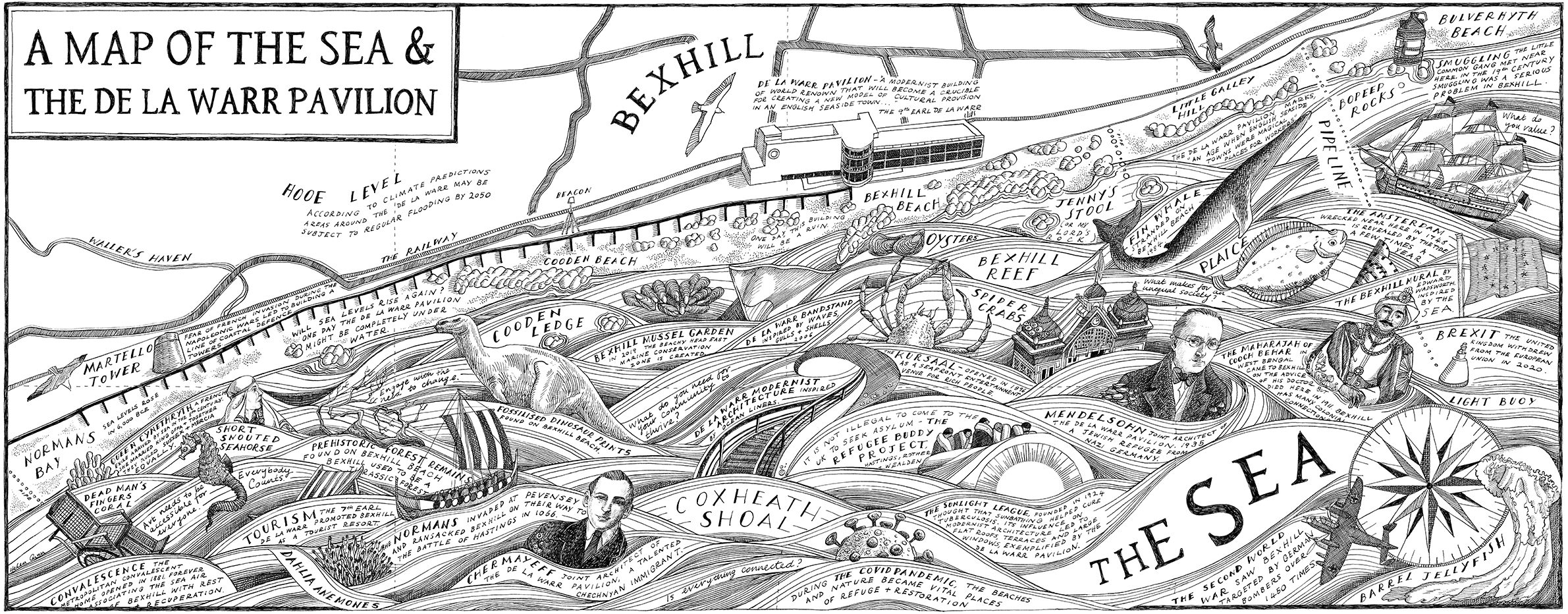
Mural: A Map of the Sea and the De La Warr Pavilion
A commission by the De La Warr Pavilion on the UK South Coast to create a mural of a map reflecting the Pavilion’s relationship with the local area. Instead of turning toward the town of Bexhill, I took inspiration from the sea which can be seen though the De La Warr’s huge Modernist windows.
Using an Admiralty chart as reference, the map shows the maritime environment of sandbanks, rocks, buoys and pipelines of Pevensey Bay. Alongside this, in the waves, other symbols are depicted – historical, environmental, political and creative – all narrating their connections with the sea.
The mural (2.6 x 6.4M) was initially drawn in pen and ink at a smaller dimension and then enlarged and printed onto archival wallpaper. The installation was part of a year long exhibition and the map has now been printed on the exterior of the outside catering stand.
Related projects
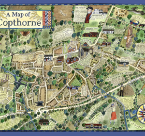
A Map of Copthorne
A map of the Sussex Weald village, Copthorne, commissioned as part of a walking and arts project, ‘About the Place’, by Mid Sussex

A Map of Crawley Down
A map of the Sussex Weald village, Crawley Down, commissioned as part of a walking and arts project, ‘About the Place’, by Mid Sussex
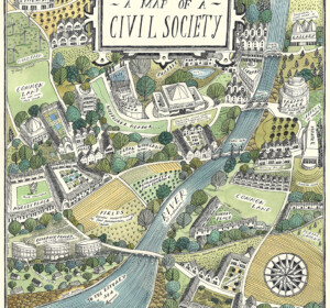
A Map of Civil Society
A map commissioned by Rethinking Civil Society, an academic project based at the University of York in collaboration with the Leverhulme Trust
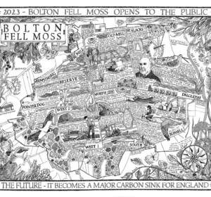
A Map of Bolton Fell Moss
A nine month project in collaboration with the University of Cumbria as an Honorary Research Fellow, National England and the PLACE collective.
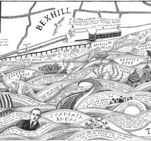
Mural: A Map of the Sea and the De La Warr Pavilion
A commission by the De La Warr Pavilion on the UK South Coast to create a mural of a map reflecting the Pavilion’s relationship with the
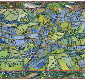
A Map of the Waterways of Oxford
An illustrated map of the waterways of Oxford showing the historic features of the city with borders of local river wildlife. Watercolour,

The Apple World
A map of the history, science and culture of the apple throughout the world, commissioned by the National Trust, the Museum of Cider and the
Mural: A Map of the Midsummer Stars above Brighton
I was commissioned to adapt my original ‘Map of the Winter Stars from the Northern Hemisphere’ into a mural by MMoser Associates. The

A Map of Gyptian Waterways in Oxford
I was commissioned by Badwolf to create this map prop of the waterways of Oxford for the BBC/HBO production of ‘His Dark Materials’ .
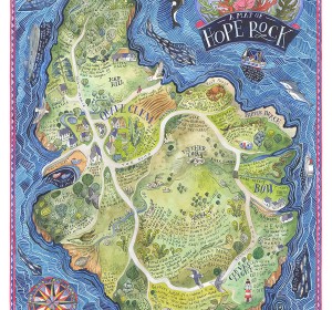
A Map of Hope Rock
I was commissioned to create this imagined island for Thames and Hudson’s ‘Archipelago; An Atlas of Imagined Islands’, edited