
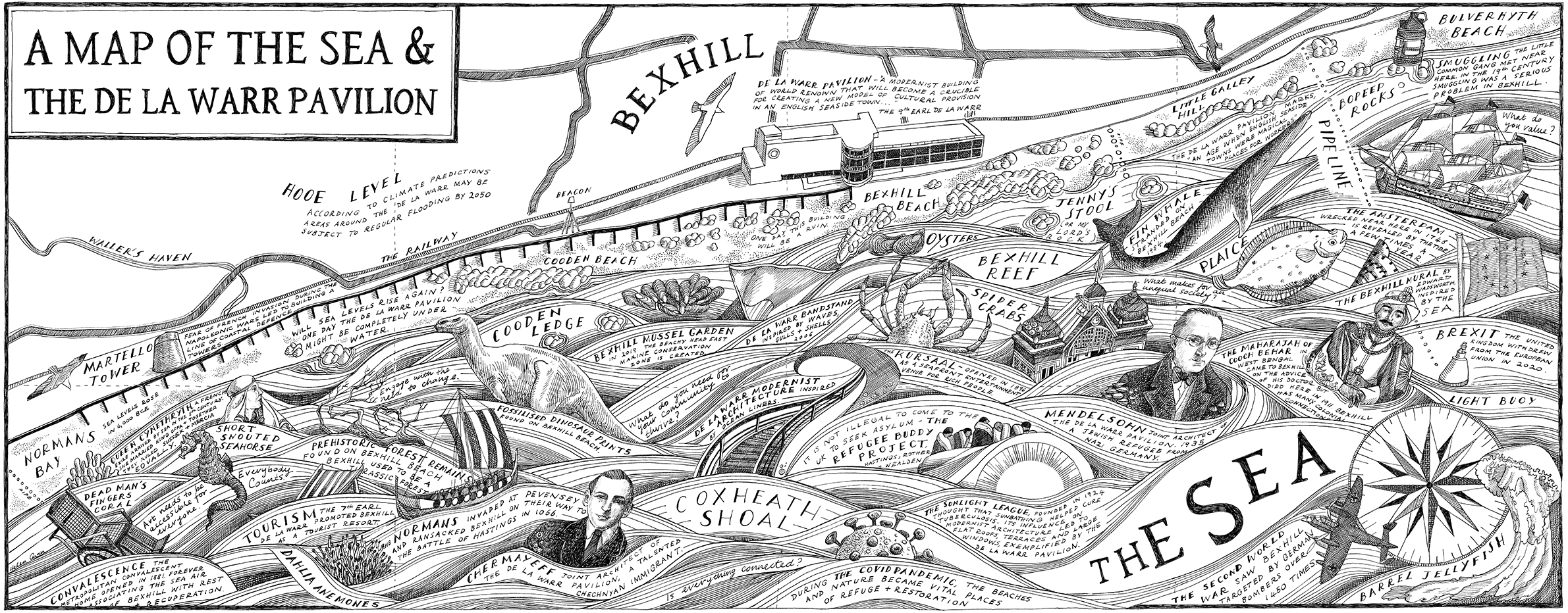
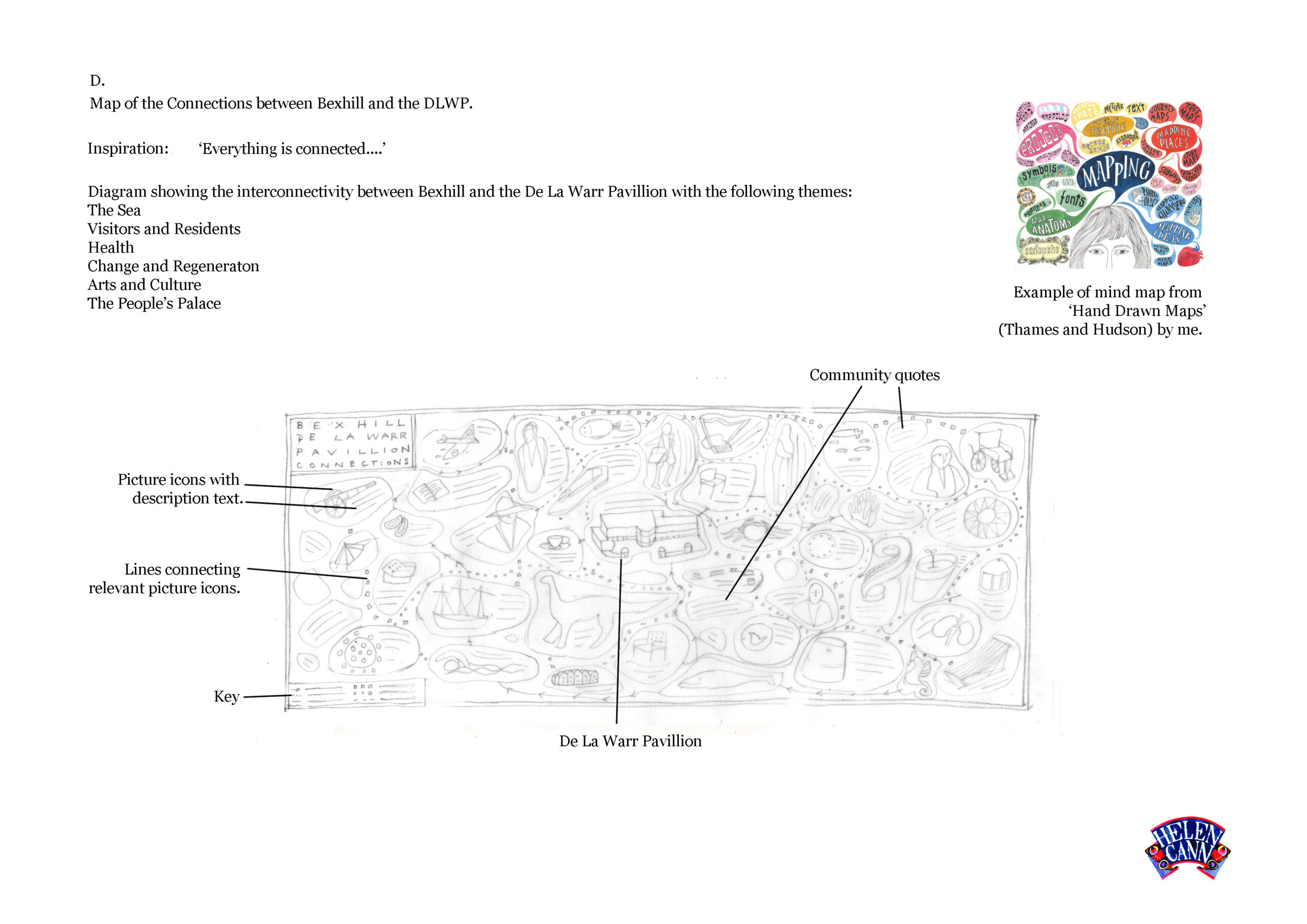
The good people of modernist icon of architecture, the De La Warr Pavilion, commissioned me to create a 2.6 x 4.6 mural of a map reflecting the building and its environment. The map was to be created at smaller dimensions and then enlarged to be printed out on archival wallpaper – eventually being shown as a stand alone exhibition in the rooftop foyer for a 6 month period.
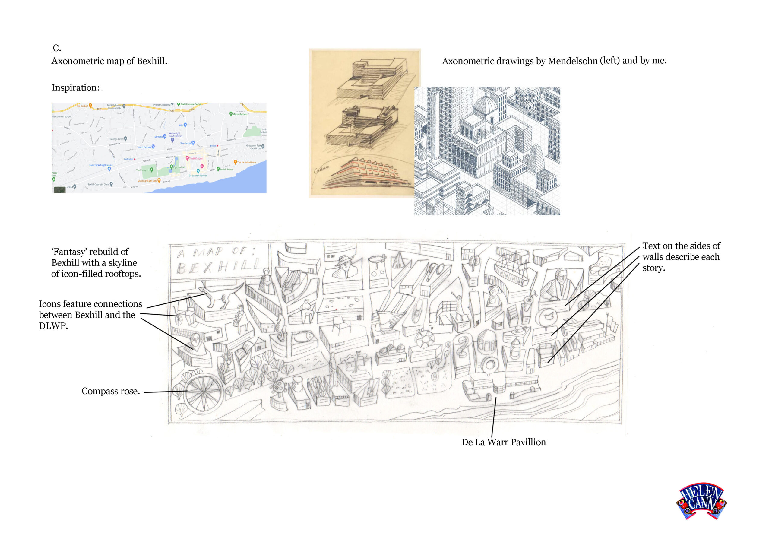
The process began with delivering four proposals of different treatments.
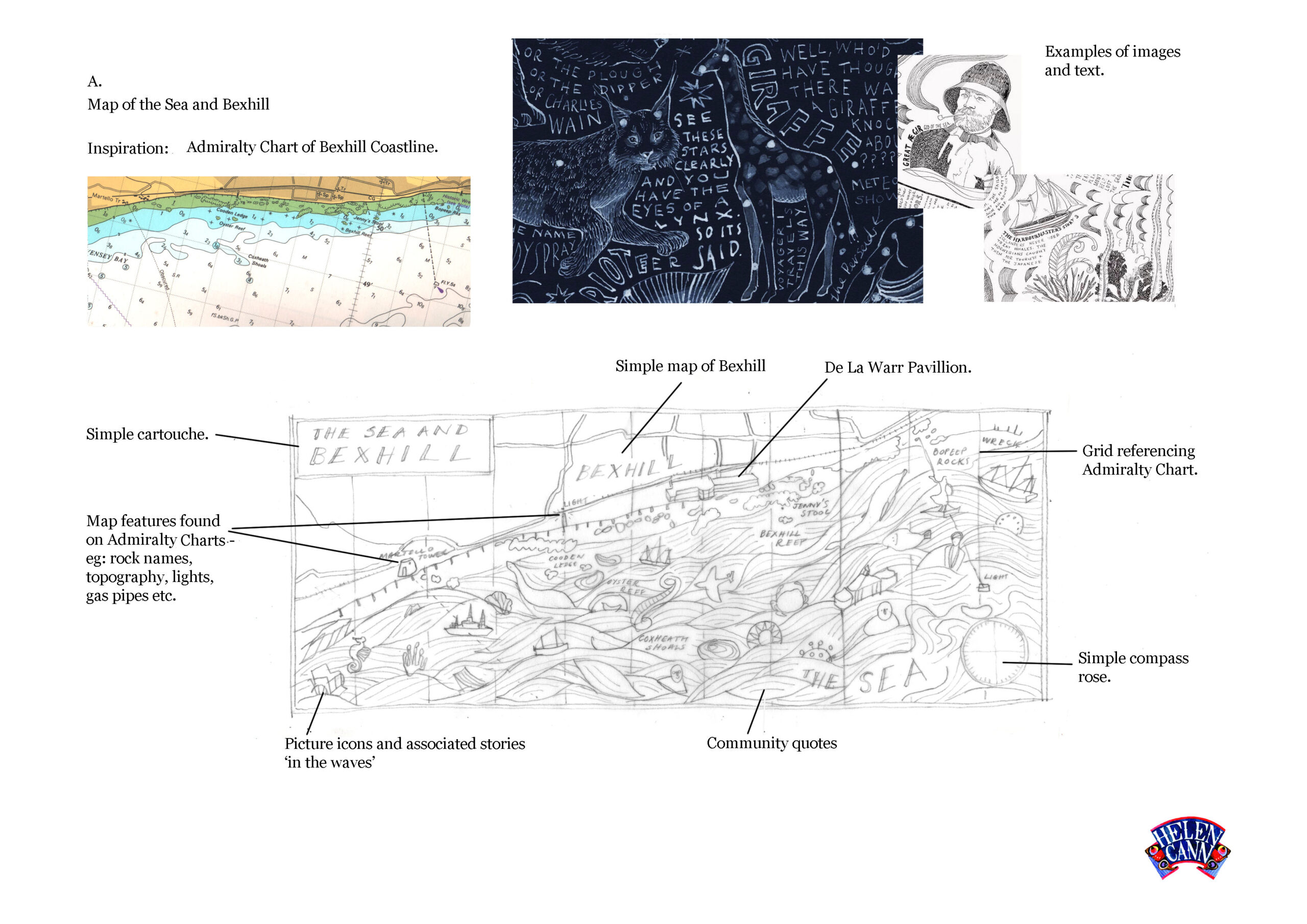
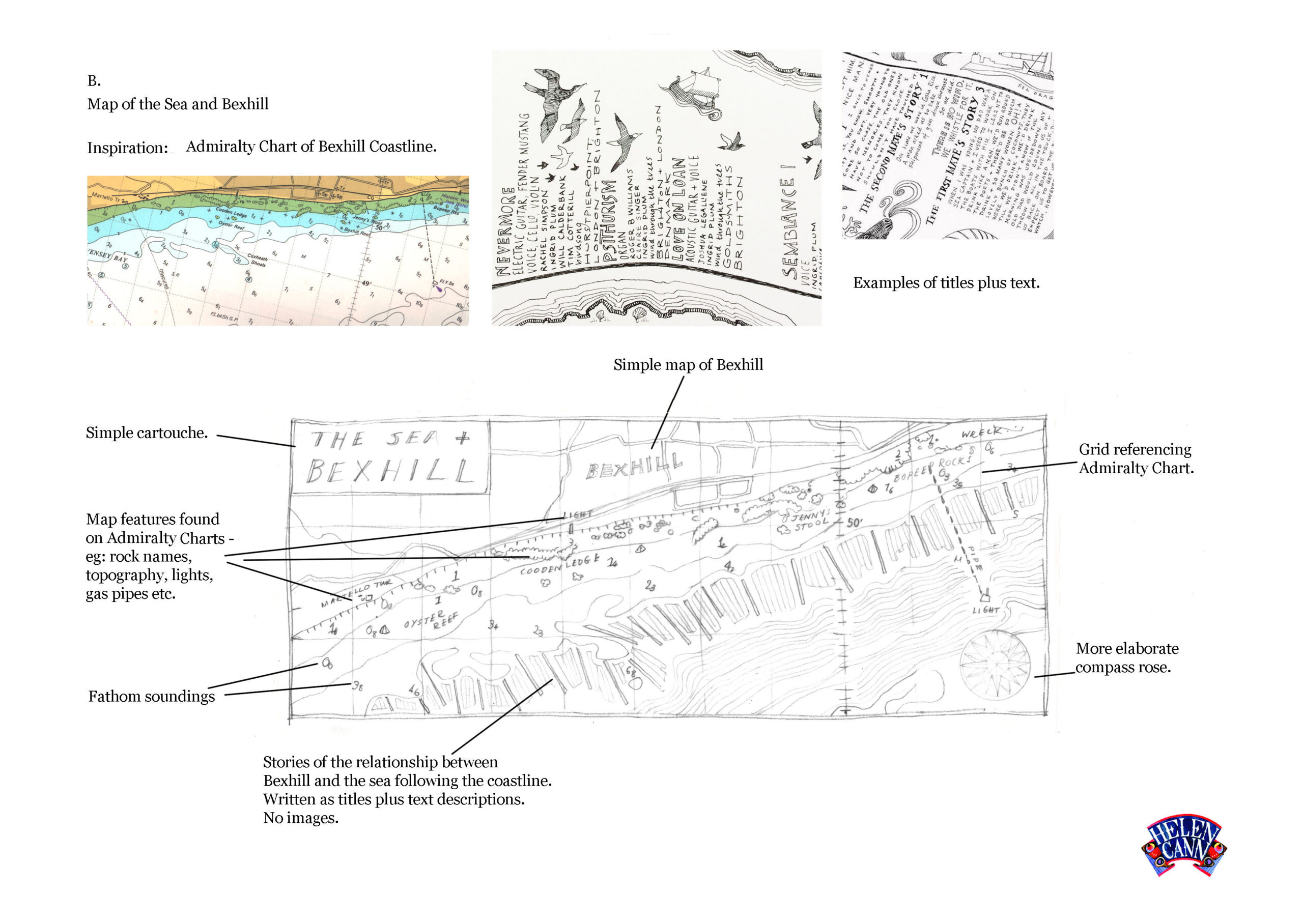
A decision was made. Instead of simply mapping Bexhill, I would turn outwards instead, to chart the seas and coastline that the De La Warr overlooks. Using the Admiralty charts that all sailors are familiar with as reference, I mapped the seascape – the buoys, sandbanks, light vessels and pipelines of Pevensey Bay.

My map swims too, with symbols of the maritime connections the town and building have.
The coastline is inherently a border – a crossover point for invaders, tourists, visitors and refugees. Some seek health from the sunshine and fresh air. Some ask for sanctuary, looking for new homes.
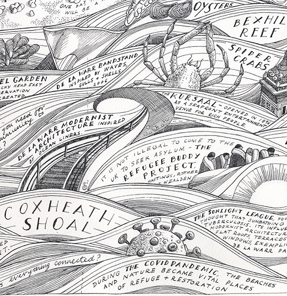
The coastline is also home to a multitude of creatures, from short nosed seahorses to spider crabs and barrel jellyfish. The area around Pevensey Bay is part of the ‘Blue Belt’, a national maritime conservation zone.
It’s a never ending well of inspiration for creativity too, reflected in the work of the artists and architects involved with the Pavilion. Most striking of all is the ocean-lineresque design of the building itself with its spiral staircases, fluid lines, flat roof and huge glassy windows.
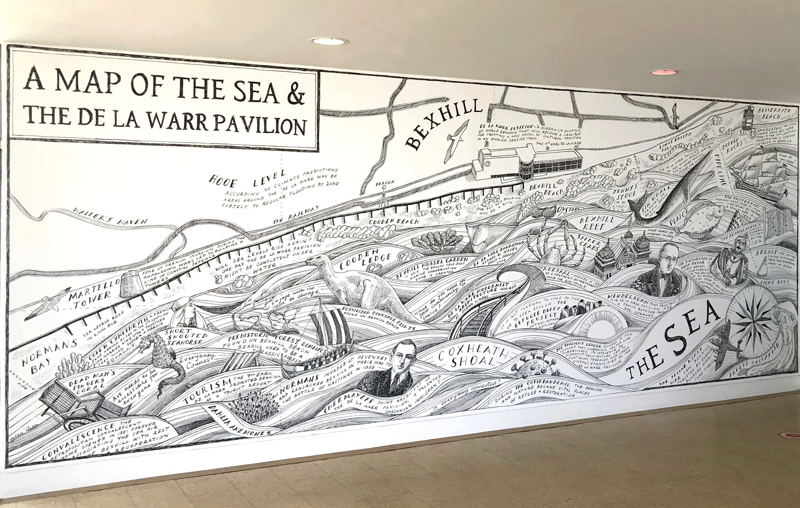
The exhibition is on show between July 2021 and January 2022 and the design can also be seen wrapping the walls of the Pavilion’s pop-up terrace bar from August 2021 onwards.