
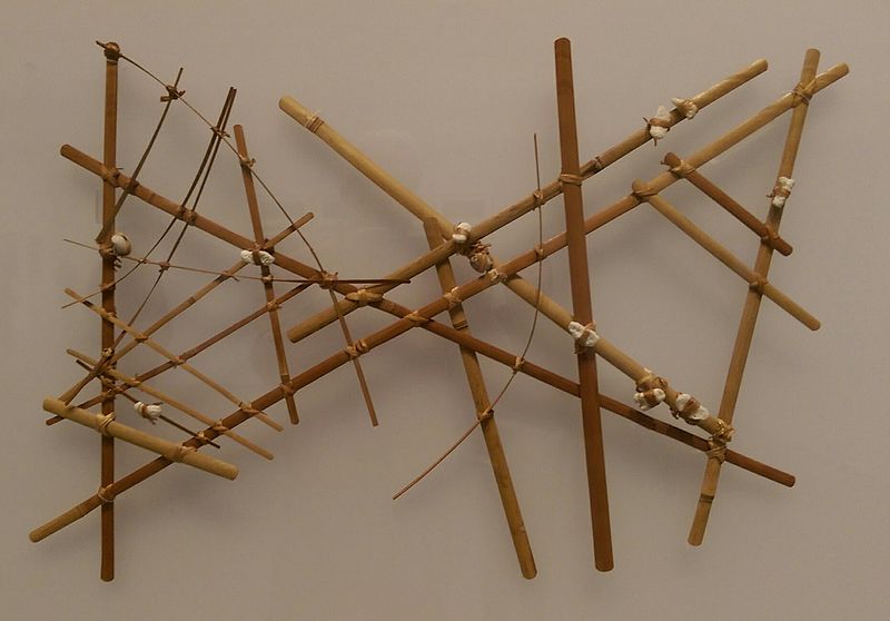
A navigational chart from the Marshall Islands, on display at the Berkeley Art Museum and Pacific Film Archive. It is made of wood, sennit fiber and cowrie shells. From the collection of the Phoebe A. Hearst Museum of Anthropology at the University of California, Berkeley. Date not known. Photo by Jim Heaphy.
Date 6 February 2016 (according to Exif data)