
The art of Pscychogeography has always interested me and walks comfortably hand in hand with my maps. Psychogeography was defined in 1955 by Guy Debord as “the study of the precise laws and specific effects of the geographical environment, consciously organized or not, on the emotions and behaviour of individuals.” And that is what interests me too – how we are effected by our surroundings – leaching out through the stories we tell of our own lives and environments, or our choice of the stories we tell of others.
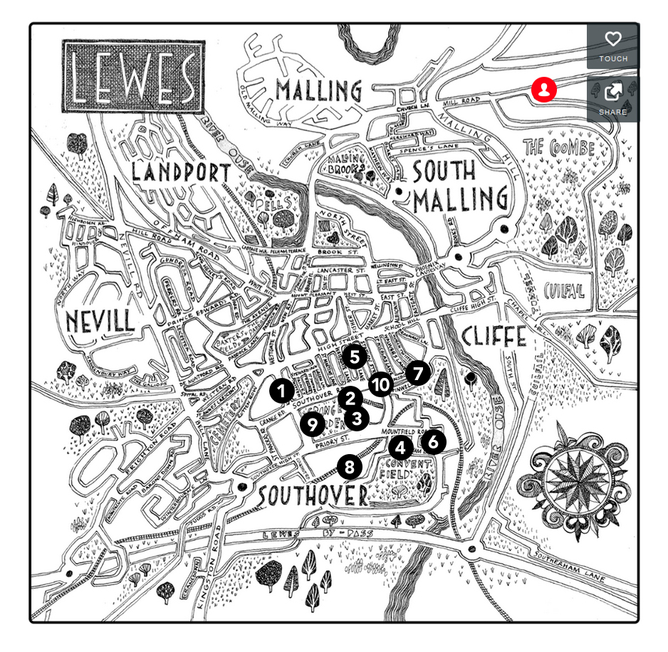
I was asked by Adam Whitehall, the creative director of the Sussex University psychogeography project, New Pathways, to create a map of Lewes (UK) that could be used to present some of his research. He had designed and facilitated a subversion of the traditional group walking tour (based on psychogeographic principles) of the town and called it ‘Mappenings’.
In the Springtime of 2014, several groups of walkers met at agreed starting points (the solid earnestness of the red brick train station or the tinny triviality of the saucepan aisle in Waitrose) on agreed dates and times in Lewes. From there, they were asked to fan out, drifting to undecided destination points. Every 20 minutes they marked their position on a tourist map and marked their response to their surroundings – through film, drawing, music, poetry or writing… This documentation became a summary of a place from multiple personal views across a period of time.
Click here to view an impression of Lewes 1st April 2015 at 7.20pm
Click here to view an impression of Lewes 1st April 2015 at 7.40pm.
Click here to view an impression of Lewes 1st April 2015 at 8pm.
Click here to view an impression of Lewes (with an April Fool’s joke included in the true spirit of psychogeographical playfulness) 1st April 2015 at 8.20pm